Coastal Endurance Array

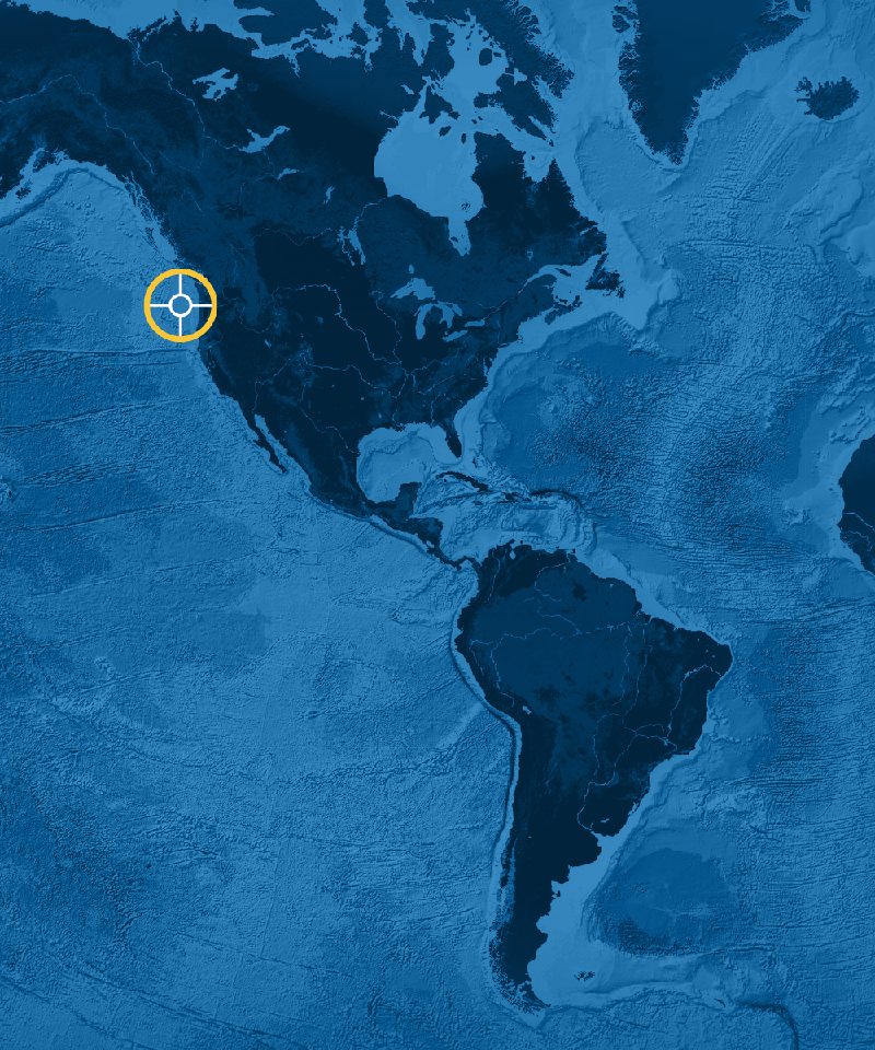
Located in the Northeast Pacific Ocean off the coasts of Oregon and Washington, the Endurance Array is part of a regional observatory network that includes OOI, Station Papa, and Ocean Networks Canada. Measurements taken by this network collectively capture variability of ocean properties across a broad range of temporal and spatial scales. The array is located in a region with coastal upwelling. These regions comprise less than 5 percent of the ocean’s surface area, yet account for a quarter of the global fish catch. Collected data allow examination of ocean health issues, including hypoxia, ocean acidification, and effects on ocean life.
The Coastal Endurance Array is made up of two cross-shelf moored array lines. The Oregon Line, off the coast of Newport, Oregon, is located at 44° 35’N, from 125°W to coast. The Washington Line, off Grays Harbor Washington, is located at 47oN, from 125oW to the coast. Gliders move and collect data around, along, and between these lines. Two Endurance Array sites include platforms connected to OOI’s Regional Cabled Array.
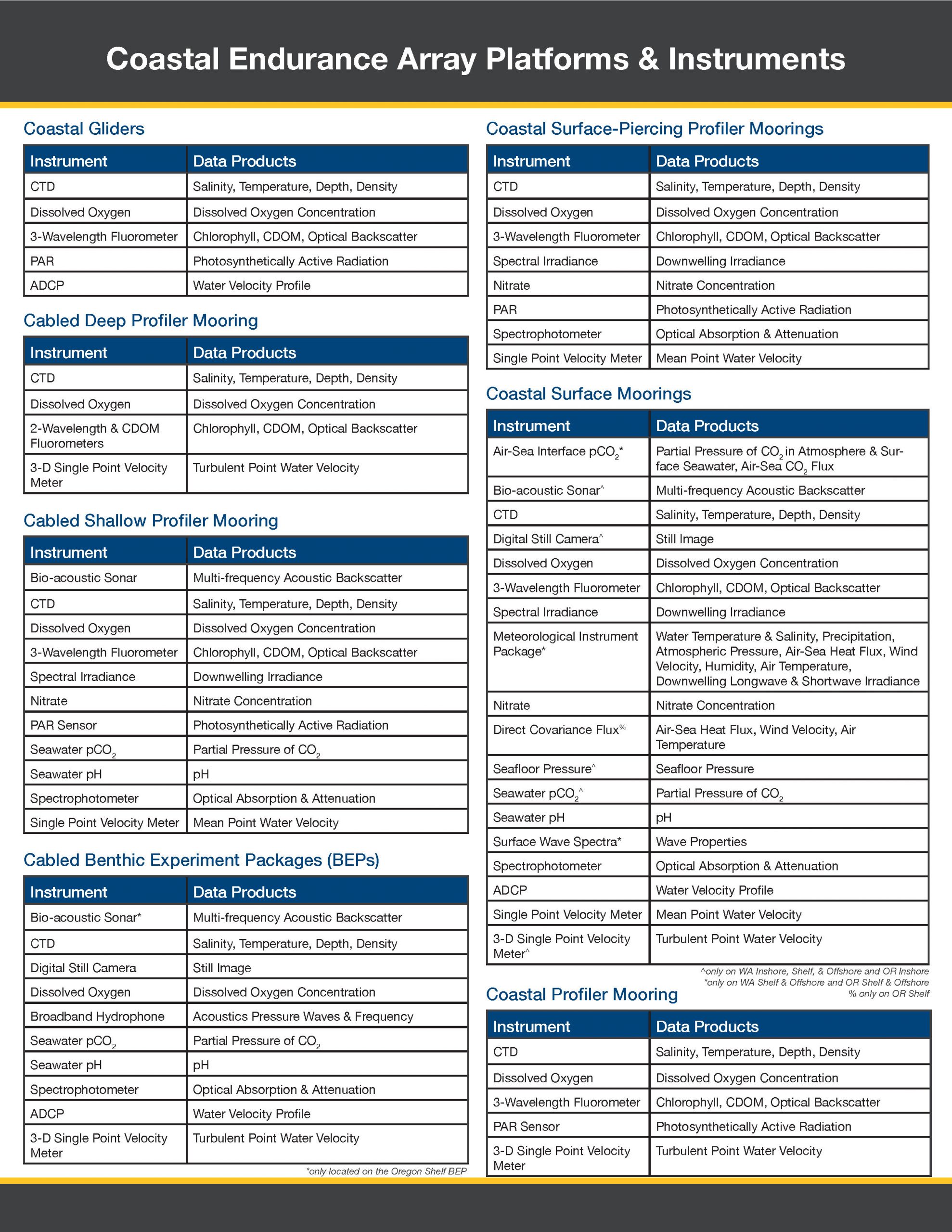
The Coastal Endurance Array is designed to observe cross-shelf and along-shelf variability in the region. Each line contains three sites spanning the slope (~500-600 m), shelf (~80-90 m) and inner-shelf (~25-30 m). The three sites across the shelf and slope are associated with characteristic physical, geological, and biological processes. All six sites contain fixed sensors at the top and bottom of the water column paired with an adjacent water column profiler.
The Oregon and Washington Lines are both affected by wind-driven upwelling and downwelling, but shelf stratification and upper-ocean properties are influenced differently by the Columbia River. The Washington Line is north of the Columbia River outflow and the Oregon Line is south of it. Observations on both sides of the river outflow allow for a greater understanding of regional coastal ocean ecosystem responses. Mooring lines provide synoptic, multi-scale observations of the eastern boundary current regime. Coastal gliders bridge the distances between the fixed sites and allow for adaptive sampling.
Regional Cabled Array Endurance Components
The Endurance Array connects with OOI’s Regional Cabled Array at the Oregon Shelf and Offshore sites. The Oregon Shelf Cabled Benthic Experiment Package is on the continental shelf at 80 meters depth.The Oregon Offshore Cabled Benthic Experiment Package (579 meters), Oregon Offshore Cabled Deep Profiler Mooring (576 meters), and Oregon Offshore Cabled Shallow Profiler Mooring (588 meters) are on the continental slope at the Oregon Offshore site.
For more information, check out the Endurance Array related news stories.
https://vimeo.com/user110037220
Sites
This array includes following research sites and platforms.
| Key | Site Name | Water Depth |
|---|---|---|
| 1 | Oregon Inshore Surface Mooring (CE01ISSM) | 25 meters |
| 1 | Oregon Inshore Surface Piercing Profiler Mooring (CE01ISSP) | 25 meters |
| 2 | Oregon Shelf Surface Mooring (CE02SHSM) | 80 meters |
| 2 | Oregon Shelf Surface Piercing Profiler Mooring (CE02SHSP) | 81 meters |
| 3 | Oregon Offshore Surface Mooring (CE04OSSM) | 588 meters |
| Mobile Assets (CE05MOAS) | ||
| 4 | Washington Inshore Surface Mooring (CE06ISSM) | 29 meters |
| 4 | Washington Inshore Surface Piercing Profiler Mooring (CE06ISSP) | 29 meters |
| 5 | Washington Shelf Surface Mooring (CE07SHSM) | 87 meters |
| 5 | Washington Shelf Surface Piercing Profiler Mooring (CE07SHSP) | 87 meters |
| 6 | Washington Offshore Profiler Mooring (CE09OSPM) | 544 meters |
| 6 | Washington Offshore Surface Mooring (CE09OSSM) | 542 meters |
| PN01C | Oregon Offshore Primary Node (PN01C) | 619 meters |
| PN01D | Oregon Shelf Primary Node (PN01D) | 115 meters |
Research Themes
Coastal Endurance Array
Approximate Water Depth
25-600mCentral Mooring Location
44.6389, -124.3038Research Setting
Eastern boundary current, coastal upwellingInstrument Table